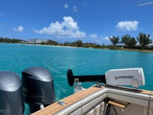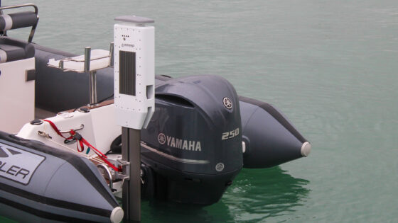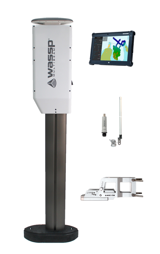
The Wassp W3Pi with Bluebeam inside

Introducing
The W3Pi wireless Wassp is used to map the seafloor, collecting precise depth and data of the area, ideal for finding the best spot to dive, fish or anchor.
Wassp is a world leading multi-beam sonar technology. Since the first installation in 2000, Wassp is now distributed in more than 30 countries and has been embraced by the commercial fishing, recreational fishing, mega yacht, hydrographic, professional workboat, navy and coastguard sectors.
Overview
The W3Pi is an integrated kit for mothership and tender. The product is designed around a mobile unit that includes a high frequency wideband fairing transducer, motion sensors, satellite compass, Wi-Fi transmitter and wireless mothership kit. With its bracket mounted pole, users can deploy the unit into the water quickly and easily, mapping in up to 400m depth.
With the Wassp W-Series, captains can use a support vessel or tender to remotely gather accurate bathymetric information, some navigation charts can be unreliable. This means faster, safer navigation and anchorage in poorly charted regions.
The live mapping data from the remote vessel is transmitted in real-time via a dedicated wireless connection directly to a mapping computer on the mothership, allowing the bridge crew to immediately view a high detail, real-time live 2D and 3D map of the underwater seafloor of the area that is being surveyed at that very moment by the remote vessel.
Who’s it for
The W3 Wireless Wassp is suitable for large vessels (yachts, cruise ships, explorer vessels, Navy) that are travelling off the beaten track, exploring new areas and navigating into shallow unchartered waters.
For vessels such as superyachts and cruise ships that are exploring remote locations, dive sites or wrecks, the W3 can help avoid obstacles and accidental damage and plan for the perfect dive, fish or anchorage. With multiple tenders, users can map the seafloor even faster and find the perfect anchorage more quickly.
With the wireless Wassp W3 system installed on a remote vessel such as a tender, chase boat or shadow vessel, it is possible to quickly perform a high-resolution bathymetric scan of the seafloor collecting precise depth and position information of the area where the mothership wishes to safely enter, such as bays, lagoons, fjords, artic areas, archipelagos, etc.

Performance Data
Full Specifications W3Pi
Transceiver Type Integrated DRX-32
Current Transducer Support Wideband Fairing
Transducer
Minimum Depth/m 1m
Typical Depth 1/m (90° or 2:1) 300m
Max Depth 2/m (53° or 1:1) 350m
Sounder Depth 3/m (NADIR) 400m
Swathe Coverage (up to) 120°
Detection Points 224 (0.54° over 120°)
Signal Type fm/cw
Default Centre Frequency 160khz
Centre Frequency Rage 120-160khz
Maximum Chirp Frequency Range +/- 30khz
Frequency From 90- 190khz
Bandwidth (up to) 60khz
Range Resolution (Max) 2cm

Beam Width Port/Starboard 4.5° (3.6° @200khz)
Beam Width Fore/Aft 3.2° (2.6° @200khz)
Sounder Beams Configurable 5-60°
DC Input 9-32V
Wireless Antenna Kit Integrated
Power Consumption (Max) 36w
Data Connection GBE
Operating Temperature 0° to 50°
Environmental Standards IEC60945, MIL-STD-901
Find out more
Visit the Wassp website for product details and local distributor information.
Contact sales & marketing director – EMEA & Americas: Rufus Whiteford
